
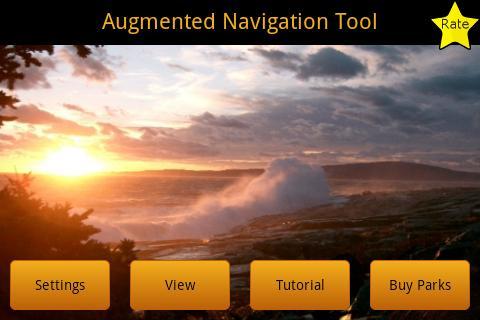
GPS maps plus Heads Up Display for visual navigation. NO ADDs! Plug-ins
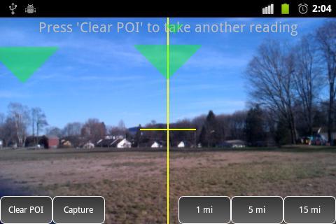
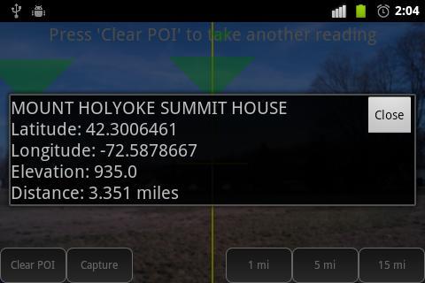
Using Android location capabilities, users can identify key points of interest through the camera view of their phone. This application merges foot navigation and virtual reality.
Developed with the support of lead National Park Service mapping specialists and safety professionals. Justice Systems Press offers data sets for areas across the United States and most recently, throughout the world. Upload this free app, and find plugins on the play store or through the 'Buy Parks" app feature.
Originally called the “National Park Backcountry Safety Tool”, Justice Systems’ staff collaborated years of Park Ranger, military mapping, and Geospatial Information Systems experience to allow park employees and backcountry enthusiasts to identify safe locations within the backcountry of the nation’s national park system. Now named ‘Augmented Navigation’ this tool has been developed for use in any area with a GPS Signal.
Contact us direct for your own personal dataset or purchase one of our plugins on Google Play. Any outdoor activity can enjoy the safety of visibly seeing a location through this app. Hikers, boaters, hunters, fisherman, National and State Park visitors will all find its value.
Features:
1. Use Google terrain maps to view your location and the location of all the points of interest around you. Terrain view can provide information about grade, canyons, and help you choose the best path to reach your destination.
2. Switch between terrain view and Augmented Navigation view to help you reach your destination easily.
We will be diligently watching for bugs and will fix them immediately!
 Download