• Home
  • Game
    Action Simulation RPG Sports Casual Cards Music Puzzle Shooting Romance
  • Apps
    Business Social Lifestyle Shopping Tools Travel Finance Education News Health
  • Blogs

English 中文(简体) 中文(繁体) 한국어 日本語 Português Español Русский العربية Indonesia Deutsch Français ภาษาไทย
Home Apps Travel Hiking in Peloponnese
Hiking in Peloponnese

Hiking in Peloponnese

1
2
3
4
5
Download
  • Version 3.4
  • Category Travel
  • Package Name anadigit.adventures.peloponnese_region_demo
  • Update Time March 25, 2025
  • Size 9.73MB
About this app

Digital guide to 17 hiking areas in Peloponnese Region

"Hiking in Pelponnese Region" is a digital field guide for hikers visiting Peloponnese, Greece. The app belongs to the topoGuide series of applications. The area covered by he app belongs to Arcadia, Argolida, Corinthia, Lakonia and Messinia.

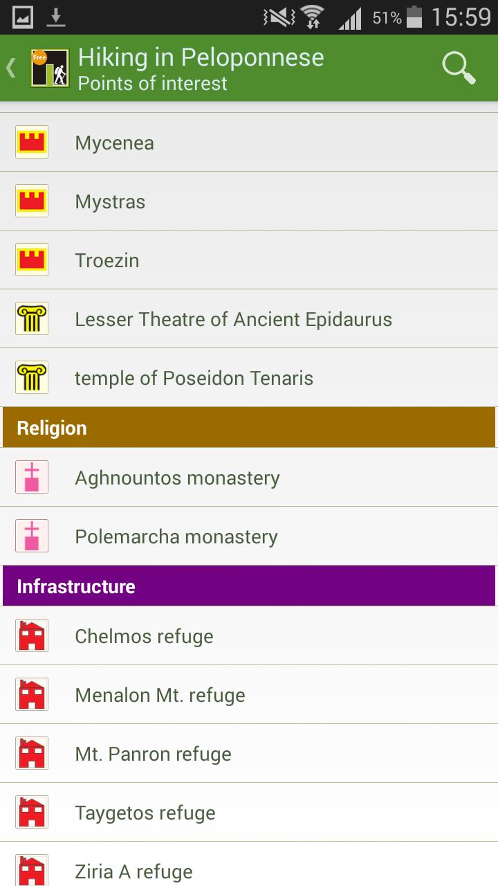
The Peloponnese Region is presented to the hiker through seventeen trails, which combine natural beauty, cultural richness, original landscapes and accommodation facilities. The app starts with an introduction on the geography, the landscapes and the nature of the 17 areas. The 17 trails are depicted on a very detailed off-line map and each one has an accurate track and a rich description with POIs and photos.

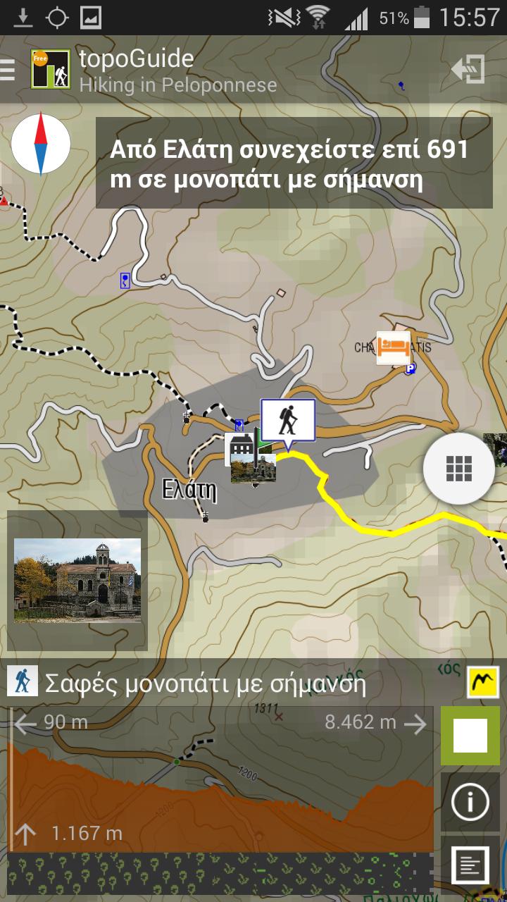
The hiker can browse the map and the chapters interactively and get any relevant information for the trails (signposting, length, time, elevation profile, vegetation type etc). The app comes with an innovative Virtual Hiker, who runs along the trail and invokes the display of all information and photos.

When in the field, the app identifies the nearest trail and provides active navigation on the path, displaying messages and warnings on every junction or other important location. On each Point of Interest, photos and texts are pop-up on the map. If the hiker gets off-trail, the app indicates the shorter way to get back safely.

The developer, AnaDigit, is the leader of digital cartographic products in Greece and has been involved in the design and creation of the most popular trail networks. AnaDigit launched recently the most advanced adventure-oriented web application, topoguide.gr

What's New in the Latest Version 3.4

Last updated on Sep 3, 2017 GPS signal precision control algorithm that enables and disables guiding and recording automatically.
Updated map legend.
Download(9.73MB)
Users also viewed
  • McDistance

    McDistance

    2.2.3 May 25, 2025
  • Visit Macon

    Visit Macon

    1.0 May 25, 2025
  • Drive Assistant HUD

    Drive Assistant HUD

    1.0 May 25, 2025
  • Play Taxi

    Play Taxi

    9.3.5 May 24, 2025
  • SafeMotos

    SafeMotos

    4.5.2 May 24, 2025
  • Weigh - Truck Weigh Stations

    Weigh - Truck Weigh Stations

    2.0.3 May 24, 2025
  • NY Car Service Passenger

    NY Car Service Passenger

    1.1 May 24, 2025
  • Easy SG Transport(Buses & MRT)

    Easy SG Transport(Buses & MRT)

    7.0.5 May 24, 2025
  • Florida 511

    Florida 511

    1.42 May 24, 2025
  • TravelMania - Hotels nearby

    TravelMania - Hotels nearby

    1.3 May 23, 2025
  • Turkey Guide

    Turkey Guide

    1.2 May 23, 2025
  • Ryan Flights

    Ryan Flights

    1.0.0.1 May 23, 2025
  • Kurviger

    Kurviger

    3.5.5 May 23, 2025
  • Parkster

    Parkster

    6.9.9 May 23, 2025
  • Station Finder

    Station Finder

    2.5.13 May 23, 2025
About Privacy Policy Terms of Service Cooking Policy

© Copyright 2017-2025 downzk.com